
Check Melbourne Bushfire Zones: 3 Steps Before You Buy
Some Melbourne properties sit inside designated bushfire prone areas, though many inner municipalities currently have none at all under the latest state mapping. The fastest way to find out is to search the address on VicPlan or MapShare, or request a council property report. The result will name any Bushfire Prone Area (BPA) or Bushfire Management Overlay (BMO) and flag whether building rules or planning permits apply.
TL;DR:
- A BPA requires new builds to meet at least BAL 12.5, while BAL 40 and Flame Zone ratings raise costs and can make retrofits impractical.
- A BMO can require a planning permit, landscape assessment, CFA referral, defendable space, firefighting water, and compliant vehicle access before development proceeds.
- A qualified assessment examines vegetation within 150 metres and the broader landscape within 20 kilometres to establish the BAL required for construction.
- Get an insurance quote for flagged addresses before budgeting, since higher premiums can affect affordability and lenders may scrutinize rebuilding and coverage risks.
- On Extreme or Catastrophic fire danger days, leave early using your district’s current AFDRS rating, rather than an outdated threshold or official warning.
WealthstackerSee How Property Risks Affect Your NumbersWealthStacker helps you assess property investments with tailored modeling for buying and rentvesting strategies.Explore WealthStacker
Table of Contents
- What bushfire terms mean: BAL, BPA and BMO
- How to check bushfire risk for a specific Melbourne address
- What a BPA or BMO designation means for building, planning and insurance
- Safety actions: CFA guidance, AFDRS and choosing your trigger to leave
- When to use overlays and professional assessments
- Which Melbourne areas sit inside bushfire risk zones
- How bushfire overlays affect property values and investment potential
- How bushfire zones can affect mortgage lending and borrowing power
- Fire prevention and mitigation measures for high-risk Melbourne properties
- Check overlay impact on your numbers with WealthStacker
- FAQ
- Sources
What bushfire terms mean: BAL, BPA and BMO
Three terms turn up constantly once you start checking a property, and they mean different things.
A Bushfire Attack Level, or BAL, measures how exposed a building is to ember attack, radiant heat and flame. The Victorian planning guidance on building in bushfire prone areas sets out six categories, each tied to construction requirements:
- BAL-LOW: minimal risk, no specific construction requirements beyond standard building practice.
- BAL-12.5: low risk, the minimum standard required for any new build inside a designated BPA.
- BAL-19: moderate ember and radiant heat exposure, requiring upgraded materials and sealing.
- BAL-29: high exposure, demanding more robust screening, glazing and roofing.
- BAL-40: very high exposure, where construction becomes significantly more expensive and complex.
- BAL-FZ (Flame Zone): extreme exposure, with the toughest construction standards in the code.
A BPA designation triggers these construction standards under AS 3959 and the National Construction Code. A BMO is different: it is a planning control applied to land assessed as carrying extreme bushfire hazard, and it can require a planning permit before you build or renovate at all.
How to check bushfire risk for a specific Melbourne address
Checking a property properly takes three steps, and each one tells you something the others do not.
- Search VicPlan or MapShare. Enter the address, then toggle on the planning overlay layers. A BPA shows as a shaded polygon over the property; a BMO appears as its own overlay layer with a schedule number that links to specific planning requirements.
- Cross-check the Victorian BPA dataset. The designated bushfire prone area dataset records gazette dates for each review. As of June 2026, inner municipalities including Melbourne, Yarra, Maribyrnong, Moonee Valley, Darebin, Boroondara, Stonnington, Glen Eira, Moreland, Port Phillip and Bayside carry no designated BPAs following the most recent gazetted review. Checking the date matters because tranche updates add and remove areas, so a clear result today is not a result for life.
- Request a council property report. Ask for the BMO schedule, any other planning overlays and the conditions attached to past permits on the site. Council planning departments handle these requests directly and can flag nuances a map alone will not show.
Pro Tip: If a map search returns a BMO or a BAL above 19, treat it as a prompt to get professional advice rather than a final answer.
Map-level checks are a screening tool, not a verdict. Where a BMO applies, or where the property sits near dense bushland, a site-specific BAL assessment from a bushfire consultant is the only way to get a construction-ready figure.
What a BPA or BMO designation means for building, planning and insurance
Once a property is flagged, the practical consequences land in three areas.
- Construction: new builds inside a BPA must meet at least BAL-12.5, and sites rated BAL-40 or BAL-FZ face far steeper material and design costs. At those upper levels, retrofitting an existing house to meet the standard is often impractical, according to the Victorian Building Authority’s bushfire overlay guidance.
- Planning: a BMO can require a planning permit even for straightforward development, and clause 53.02 of the planning scheme can demand a Bushfire Hazard Landscape Assessment and referral to the CFA before council will sign off.
- Insurance: BPA or BMO status can influence premiums and, in some cases, the availability of cover. It is worth asking an insurer directly how a specific overlay affects a quote before committing to a purchase.
None of this is static. Victorian bushfire planning guidance treats landscape and site conditions as subject to periodic review, so a BPA or BMO status checked today is worth revisiting as gazetted updates roll through.
Safety actions: CFA guidance, AFDRS and choosing your trigger to leave
Knowing the overlay status matters less than knowing what to do on a bad fire day. The CFA’s guidance on when to leave is blunt: decide on a personal trigger to leave well before fire season starts, and leave early on Extreme or Catastrophic days. Official warnings can arrive too late, and sheltering in a house that has not been prepared for ember attack is extremely dangerous.
Many Victorian households still base their fire plans on outdated danger thresholds rather than the current Australian Fire Danger Rating System, which the CFA notes has replaced the older McArthur-based ratings used for years. Aligning your trigger to your Fire Weather District’s AFDRS rating, rather than an old rule of thumb, keeps the decision current.
Practical preparation includes:
- Clear defendable space around the house, following the CFA’s 10/30 and 10/50 clearing guidance where it applies.
- Maintain gutters, screens and garden beds year round, not just before summer.
- Download a CFA bushfire survival plan template and fill it in with the whole household.
When to use overlays and professional assessments
Maps are a starting point, not a final word. A BPA or BMO overlay tells you a property sits in a flagged area; it does not tell you the exact BAL rating a new build or renovation would need to meet. For that, planning provisions call for a Bushfire Hazard Site or Landscape Assessment, carried out by a qualified assessor who looks at vegetation within 150 metres and the broader landscape within 20 kilometres.
- Use VicPlan and the BPA dataset to screen a shortlist of properties quickly.
- Reserve a paid site assessment for properties with a BMO or a BAL you suspect sits above 19.
- Revisit the overlay status periodically, since gazetted reviews can shift boundaries.
Pro Tip: Screen suburbs broadly first, then spend on a professional assessment only for the handful of addresses that clear the initial check.
Our suburb data and hazard overlays are built for exactly this first pass, giving investors a periodic read on exposure alongside valuation and borrowing figures, before anyone pays for a formal site assessment.
Which Melbourne areas sit inside bushfire risk zones
Bushfire overlays in greater Melbourne are not evenly spread. They concentrate heavily in the outer green wedge and hills suburbs, where housing meets bushland or dense vegetation corridors, rather than in the dense inner core.
Outer eastern and north-eastern suburbs bordering the Dandenong Ranges and Yarra Valley, along with pockets of the Macedon Ranges to the north-west and the Mornington Peninsula hinterland, carry some of the more extensive BPA and BMO coverage in the metropolitan area. Properties backing onto state forest, reserve land or steep vegetated gullies anywhere in these corridors are the ones most likely to return a BPA or BMO result on a map search.
By contrast, the Victorian BPA dataset shows that as of the most recent gazetted review, inner municipalities including Melbourne, Yarra, Maribyrnong, Moonee Valley, Darebin, Boroondara, Stonnington, Glen Eira, Moreland, Port Phillip and Bayside carry no designated bushfire prone areas at all. That is a function of vegetation cover and urban density, not an exemption from mapping updates: a future gazetted review could add or remove areas anywhere in Melbourne.
This is why a suburb-level assumption is not enough. Two properties a few streets apart can return different results depending on their proximity to a specific stand of vegetation or reserve, which is exactly what the address-level VicPlan search is designed to catch.

How bushfire overlays affect property values and investment potential
A confirmed BPA or BMO does not automatically devalue a property, but it changes the cost structure a buyer or investor has to factor in. Higher BAL requirements add to construction and renovation budgets, and a BMO’s permit and assessment requirements add time and professional fees to any development plan.
For investors weighing a purchase, those extra costs sit alongside the usual return calculations: rental yield, capital growth expectations and holding costs. A property in a BMO that still clears a reasonable BAL rating might remain a sound investment once the extra construction and insurance costs are priced in; a property requiring BAL-40 or BAL-FZ construction carries a materially higher cost base that needs to be weighed against expected growth.

Buyers researching outer growth corridors or hills suburbs should treat overlay status as a line item in due diligence, not an afterthought discovered after an offer is accepted. Running the numbers on a specific address, including how a BPA or BMO might affect ongoing costs, is far easier before signing a contract than after. This is where comparing a straight purchase against a rentvesting approach, holding an investment property elsewhere while renting where you actually want to live, can make sense for buyers put off by the added cost of building in a flagged zone.
How bushfire zones can affect mortgage lending and borrowing power
Lenders assess risk on a property as well as on a borrower, and a bushfire overlay can factor into that assessment. A property in a BPA or BMO may attract closer scrutiny during valuation, particularly where construction standards affect the cost of rebuilding or insuring the asset the loan is secured against.
Insurance availability and premium cost matter here too. Where a lender requires proof of adequate building insurance as a condition of approval, a property with a BPA or BMO that drives higher premiums can affect the overall cost of holding the loan, even if it does not change the approved loan amount itself.
For buyers calculating borrowing power, it is worth getting an insurance quote for a specific flagged address before finalising a budget, since that ongoing cost sits alongside loan repayments in any realistic affordability calculation. A property that looks affordable on repayments alone can look different once insurance and any BAL-driven construction costs are added to the picture.
Fire prevention and mitigation measures for high-risk Melbourne properties
Properties in BPA or BMO areas face specific prevention requirements rather than general advice. Under the BMO, planning provisions can mandate defendable space, a reliable water supply for firefighting and clear vehicle access as conditions of a permit, drawn from the Bushfire Management Overlay planning guidance.
- Maintain defendable space clearances year round, following the CFA’s 10/30 and 10/50 guidance where it applies to the property.
- Install and maintain ember-resistant screens, sealed gaps and non-combustible materials matched to the property’s BAL rating.
- Keep a dedicated, accessible water supply and ensure vehicle access meets the standard set in the permit conditions.
- Review and update bushfire survival plans annually, particularly after any gazetted change to the property’s overlay status.
These measures are not optional extras in a BMO: they are usually conditions attached directly to the planning permit, and a council can enforce them on resale or redevelopment.
Check overlay impact on your numbers with WealthStacker
Checking an address on VicPlan tells you whether an overlay applies. It does not tell you what that overlay does to your borrowing power, your expected return or your long-term net worth if you buy anyway. That is the gap we built WealthStacker to close.
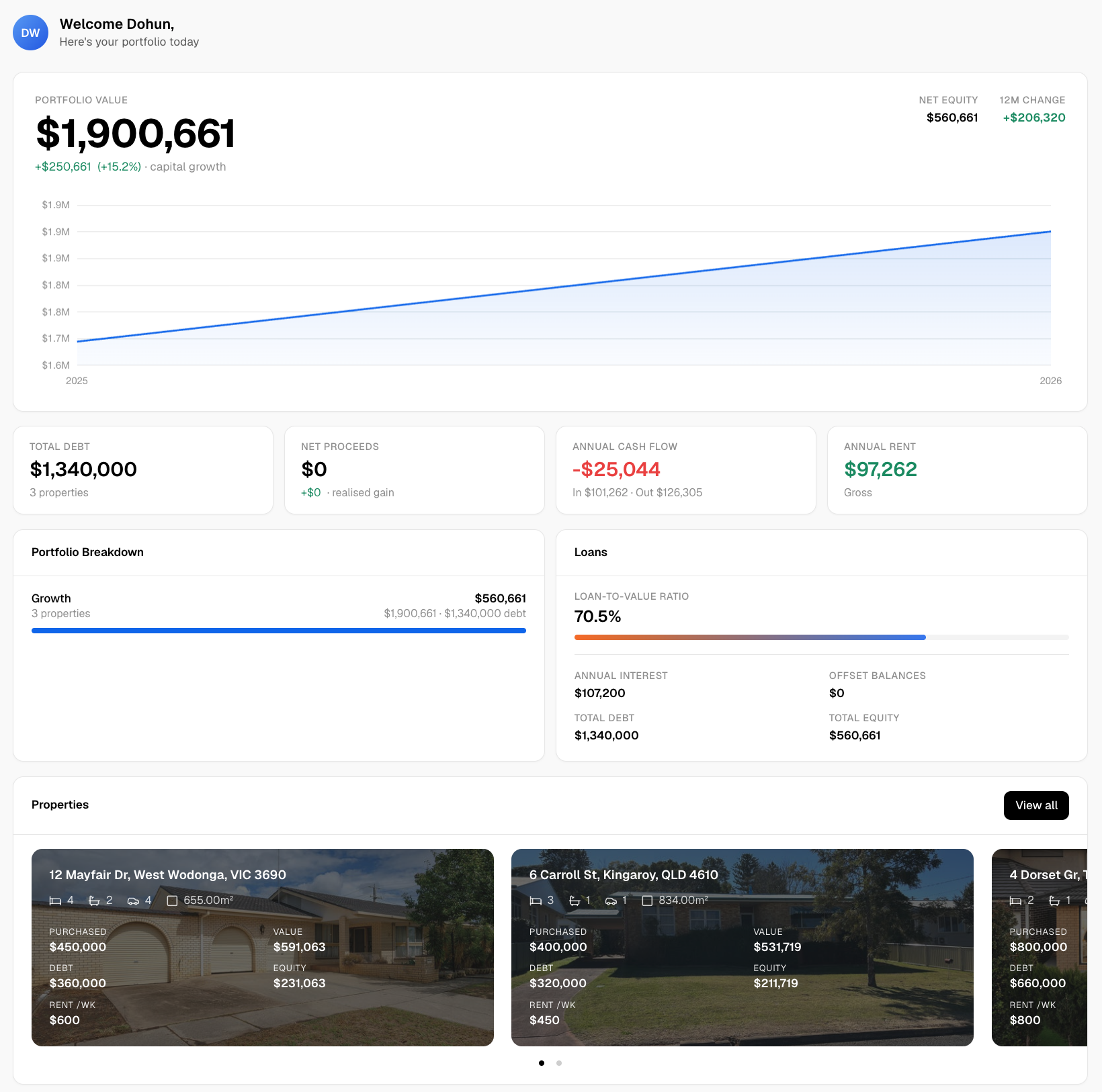
The platform provides automated quarterly property valuations, suburb-level hazard overlays and long-term scenario modelling that compares buying against rentvesting for a specific address. If a property you are considering sits in a BPA or BMO, these tools let you see how that status plays into the broader financial picture rather than treating it as an isolated flag on a map.
- Run a free property or suburb check through our platform before you commit to an offer.
- Model a rentvesting scenario against a straight purchase for the same budget.
- Track how valuation and borrowing power shift over time as your circumstances change.
Join the waitlist to start monitoring a Melbourne property or suburb today.
FAQ
Can you show me a map of bushfire prone areas in South Australia?
Bushfire prone area mapping is managed at the state level, and South Australia runs its own system separate from Victoria’s BPA dataset and VicPlan. For a South Australian property, check that state’s own planning and emergency services mapping tools rather than the Victorian resources referenced in this guide.
What does a BAL 40 fire rating mean?
A BAL-40 rating means a property faces very high exposure to ember attack, radiant heat and flame, according to Victorian planning guidance. Building or retrofitting to this standard involves significantly more robust materials and design than lower BAL categories, and retrofit options for existing homes are often limited.
How do I create a fire plan?
Start with the CFA’s bushfire survival plan template, which walks through deciding a personal trigger to leave and preparing the household and property. Review and update the plan each season, aligning your trigger to your district’s current Australian Fire Danger Rating System rating.
Which Australian state is most prone to bushfires?
Bushfire risk varies by region rather than sitting evenly across any one state, and it depends on vegetation, climate and terrain rather than state borders alone. Checking address-level mapping, such as VicPlan for Victoria, gives a far more useful answer for a specific property than a state-wide generalisation.
Does WealthStacker replace an official bushfire check?
No, our platform is designed to sit alongside official sources like VicPlan and the Victorian BPA dataset, not replace them. We help you monitor suburb and property data over time and model the financial impact of a hazard-flagged property, while the official maps remain the authority on overlay status itself.
Sources
- Building in designated bushfire prone areas — planning.vic
- When to leave — CFA
- Building in the bushfire management overlay — planning.vic